Resilient Consulting Water Resources Case Study
How Resilient Consulting uses Equator to source topographic data for water resources projects

Overview
Founded in 2018, Resilient Consulting delivers environmental and water resources solutions. Their typical projects range from feasibility studies right through to construction.
The team applies the principles of resilience, sustainability and adaptability to everything they do. Their mission is ensuring that community infrastructure is ready to withstand changing pressures from increased human demand, changing natural conditions and evolving regulations. Above all else, they pride themselves on providing high quality engineering services to local clients in Southern Ontario.
Challenge
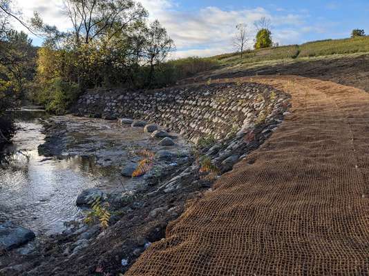
Water resources projects are often located in isolated areas. Access and quality imagery can be limited when working on floodplain mapping, hydrologic modelling, stormwater management and design. A lack of quality background information can make preliminary design inefficient and sometimes even inaccurate. A big reason for this is missed site constraints in planning – especially at the proposal stage!
Solution
After being introduced to Equator, the team quickly recognized the platform could significantly help during the proposal and preliminary design phases. Before Equator, the team would search through multiple online open data portals – a time consuming process! If topographic information was not available, or readily accessible, they would have very little idea about constraints or opportunities on the site. Often, they would have to wait until awarded the project to conduct topographic surveys on the ground. This means a rriving at a site visits without a clear idea of what they would find.
Once they started using Equator, they could quickly find available open GIS data for their projects and integrate it with their own markups in a dynamic map. Equator has become a frequently used tool on many proposals and projects to provide this background information and to assess available data.

“Equator has been a great resource for topographic information when assessing potential bid opportunities. Many sites can require complicated topographic survey which have been assessed using Equator to accurately budget the time for the survey.”
— BECKY TURBITT, PROJECT ENGINEER @ RESILIENT CONSULTING
In addition, Resilient has used Equator on a number of projects where topographic information was lacking. The options for sourcing high quality topographic data were limited and prohibitively expensive. Equator provided quick access to reliable topographic information using provincially funded datasets.
In addition, data sourced using Equator has been used to delineate catchment areas for a wide variety of projects: from storm sewer design to assessing creek bank slopes for topographic survey.
The engineers and planners at Resilient have appreciated Equator’s ability to grant them fast access to high quality data. This includes unprecedented insight into the topography of their sites, right from their desktops. All this means better designs, cost effective budgets and efficient use of staff resources.
“Equator has created a one stop shop of available and accessible online data sets. This tool is frequently referenced to assess tricky bid opportunities and to supplement preliminary design. ”
— BECKY TURBITT, PROJECT ENGINEER @ RESILIENT CONSULTING

Sample contours (created from Ontario LiDAR) created in Equator, including labels, imagery and watercourses
View your project site during the RFP to identify any potential issues and alleviate any headaches (and additional costs) during the design phase.
The post Resilient Consulting Water Resources Case Study appeared first on Equator .
Full content in Equator Studios

