Default base topography (low-resolution)
User Guide / Default Base Topography (low-resolution)
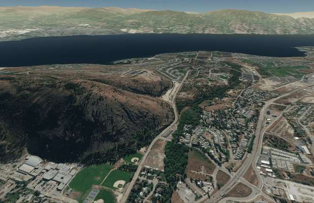
Default Base Topography (low-res)
In this tutorial, we describe the source and quality of the default, built-in 3D topography.
Guide
By default, the terrain in Equator is built from the ASTER Global DEM. The accuracy of the default terrain is in the range of 20-30m. Equator provides the user the option to improve the accuracy of the terrain surface using public LiDAR data available locally (described in the following sections).

The post Default base topography (low-resolution) appeared first on Equator .
Full content in Equator Studios

