Lincoln Nebraska Topographic Map: view and extract detailed topo data


Topographic Maps for Professionals
Lincoln topographic maps, accessible in Equator, are used by infrastructure design professionals such as:
- Planners
- Architects
- Civil Engineers
- Flood Analysts
- Construction Professionals
- Landscape Designers
What is possible with the topographic map?
The Lincoln topographic map can be used for:
- Viewing 3D surfaces from high-quality LiDAR
- Generating and view contours
- Sourcing and view LiDAR beautiful point clouds
- Cut cross sections
- Extract elevation data
- Create markups, labels and figures
- Link sharing data


Where is the topographic data sourced from?
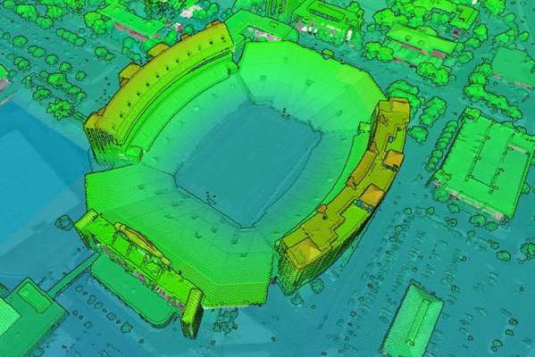
The Lincoln topographic data is sourced from the United States Geological Survey (USGS), specifically their 3D Elevation Program (3DEP). You can read more about the 3DEP here . In general, built-in Lincoln elevation data is sourced from a library of airborne LiDAR surveys that are managed by the USGS, and connected to Equator for easy access.
Can I extract contours from Equator?
Yes! Contours can be extracted from the Lincoln topographic map at any resolution. Export contours to to shapefile (.shp) or drawing (.dxf). Digital elevation models (DEMs) are also available.

How do I bring contours into Civil 3D?
Contours can be opened in AutoDesk Civil3D (or similar) simply by opening an dxf file or shapefile exported from Equator. This tutorial explains how to create a 3D surface in Civil 3D directly from a shapefile.

Why should I use Equator to access Lincoln Topography?
Equator allows users to access local LiDAR surveys in the best available resolution. Experience 3D topography in high-resolution, unlike ever before.
Revolutionary 3D platform for viewing data
Most detailed online map of Lincoln topography, accessible on a globe
Easily extract the data you need
The post Lincoln Nebraska Topographic Map: view and extract detailed topo data appeared first on Equator .
Full content in Equator Studios